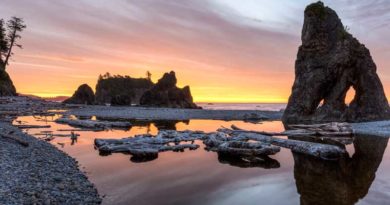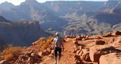
The 8 Hiking Trails in Gatlinburg TN with Waterfalls
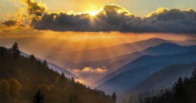
Gatlinburg, Tennessee is located south to the Pigeon Forge and surrounds the Great Smoky Mountain National Park. Because of it, Gatlinburg is a popular tourist destination. There are many attractions for tourists. The smokies, of course, attract thousands of hikers from all over the world making the city a popular destination for hikers as well.
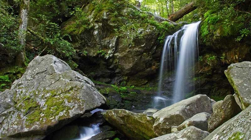
Among several opportunities for outdoor activities, hiking trails with waterfalls are one of the most exciting. One of the reasons is because it surrounds the Smokies which checks the two requirements essential for having a lot of waterfalls; waterfall-ample rainfall and elevation gradient.
Each year the high country receives an average of over 85’’ of rainfall each year. During the wet years, the peaks of the Smokies receive over eight feet of rainfall. This abundant rainfall trickles and rushes down the mountainsides forming amazing waterfalls.
So if you are looking to visit Gatlinburg, here are the 8 hiking trails with waterfalls that you should visit.
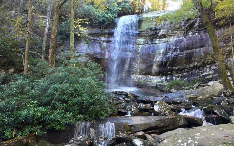
1. Grotto Falls Trail
- Waterfall Height: 25-feet
- Distance: 2.6-mile round trip
- Level: Easy
- Elevation Gain: 585-feet
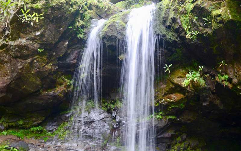
The mist of the Grotto Falls creates a natural air conditioning effect making it a nice place to cool off in the warm summer months. Grotto Falls is also one of the most family-friendly hikes in the area.
Grotto Falls is a unique waterfall in Gatlingburg because it is the only waterfall that you walk behind. It can be reached via a moderately difficult 2.6-mile roundtrip hike along the Trillium Gap Trail. The Trillium Gap Trailhead is located just outside of Gatlinburg which is the starting point of the hike to Grotto Falls in the Great Smoky Mountains. The first section of the trail is technically an access trail.
You will witness a variety of wildflowers along the way if you get the opportunity to hike this trail during the spring. Among these flowers, you can find yellow trillium, white violets, squaw corn, Dutchman’s breeches and stitchwort which are common in the area.
For the most part, the trail to the waterfall travels a gentle grade along a wide and well-worn path. There are four small streams that you will come across not having the facility of a footbridge as you proceed to the falls. You will reach the tumbling cascade at 1.2-miles. Looking upstream beyond this point will give you the view of Grotto Falls for the first time.
2. Abrams Falls Trail
- Waterfall Height: 20-feet
- Distance: 5.2-mile round trip
- Level: Moderate
- Elevation Gain: 675-feet
Abrams Falls is located in the popular Cades Cove region of the smokies. This waterfall is located in Abrams Creek and is the largest volume waterfall in the Smokies. The large volume of water creates strong currents that are dangerous for swimmers. The rocks are also slippery with moss and water from the falls.
Abrams Falls is only 20-feet high. But it makes up for that lack of height with its strength. The large volume of water from this waterfall makes it impressive to look at. The Abrams Falls Trailhead is located at the far western end of Cades Cove.
The roundtrip distance of this trail is 5-miles and it is rated moderately difficult. You would have to drive 4.8-miles along the one-way Cades Cove Loop Road to reach the trailhead. The trail offers many scenic overlooks with a total elevation gain of 340-feet. The highest elevation point of this trail reaches 1,710-feet.
Backpacker Magazine listed its top 10 most dangerous hikes in America in their October 2008 issue. The list was based on the casualty statistics as a result of several measures e.g. lightning, altitude, drowning, etc. Surprisingly, the magazine ranked Abrams Falls the ninth most dangerous trail in the country, mainly because of high exposure to drowning and hypothermia hazards. The article also cited 29 deaths on the trail since 1971 due to water-related incidents.
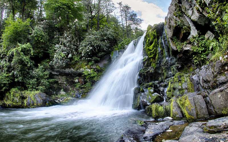
3. Laurel Falls Trail
- Waterfall Height: 80-feet
- Distance: 5.2-mile round trip
- Level: Easy
- Elevation Gain: 314-feet
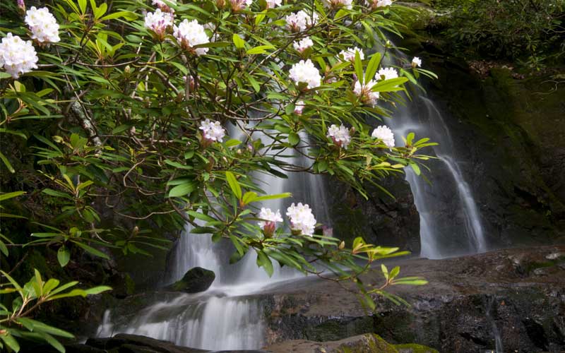
This 80-foot high waterfall is named after the mountain laurel, an evergreen shrub that blooms near the falls during the month of May. Laurel Falls is by far the most popular waterfall in the Smoky Mountain National Park. The waterfall consists of an upper and a lower section which is divided by a walkway that crosses the stream at the base of the upper falls.
Laurel Falls Trail was built in 1932 to provide fire crews’ access to Cove Mountain in case a forest fire was to occur in the area. The Cove Mountain Fire Tower was also completed by the workers in 1935.
By the 1960s, the trail began to experience high levels of erosion because it had quickly become a frequent path for hikers. The erosion leads to the pavement of the Laurel Falls Trail by the Department of Interior in 1963.
The Laurel Falls Trail is 2.6-miles long and it is the longest among the four paved trails in the Smoky Mountain National Park. As a tourist destination, it can get busy and parking at the trailhead is limited so it has to be planned accordingly.
The hike to Laurel Falls begins from Fighting Creek Gap on Little River Road, located 3.8 miles west of the Sugarlands Visitor Center near Gatlinburg. The main parking lot for Laurel Falls will be on your right, with additional parking across the street.
4. Cataract Falls Trail
- Waterfall Height: 25-feet
- Distance: 1.5-mile round trip
- Level: Easy
- Elevation gain: 29-feet
A visit to Cataract Falls is perfect for families with young children! The hike to this 25-foot high waterfall is only 0.75-miles long and it is located less than 10 minutes away from downtown Gatlinburg.
You won’t have to worry too much about this trail being busy when you visit because it is one of the lesser-known trails in the park. Kids love crossing the bridges along the trail and people love it because it is less than 2-miles from downtown Gatlinburg. Most of the trail is paved and well maintained and the waterfall drops 25-feet into a small pool below.
The trailhead is direct to the left of the Sugarlands Visitor Center (looking from the parking area). The trail starts off and turns to gravel quickly. There are well-maintained bridges that cross over the Fighting Creek in several spots on the way to the waterfalls offering guests a closer look at the creek below.
Immediately prior to one of the bridges, there is an old tree that is hollow. Kids enjoy crawling inside this odd looking tree and it makes a perfect photo opportunity! The trail is primarily used for hiking, walking, nature trips, and bird watching and is best used from May until November. It’s a great waterfall for those who aren’t ready for more ambitious hikes.
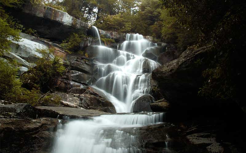
5. Rainbow Falls Trail
- Waterfall Height: 80-feet
- Distance: 5.4-mile round trip
- Level: Moderate
- Elevation Gain: 1685-feet
Rainbow Falls is located scenic slopes of Mount LeConte. Rainbow Falls is named for the beautiful colors created by the light passing through the mist of the waterfall. The 80-foot waterfall is the tallest single-drop waterfall in the Smoky Mountains National Park. The waterfall forms beautiful cascades over the extending cliff face and then rushing over rock formations at the cliff’s base.
The round trip distance to the waterfall is 5.4 miles and the hike is generally considered moderate in difficulty. However, due to the length, elevation gain, and rocky terrain in sections of the trail, some visitors may rate the hike as difficult.
Located just outside the city, the hike to the Rainbow Falls begins at the Rainbow Falls Trailhead. Starting from Light 8 in, turn onto Historic Nature Trail / Airport Road. After driving 0.7 miles veer right onto Cherokee Orchard Road, upon which you’ll enter into Great Smoky Mountain National Park.
The trail to Rainbow Falls is very well-traveled and one of the oldest in the park. The terrain, however, can often be uneven and can be rocky in places. It is recommended that you wear good, sturdy shoes. Sandals and flip-flops without good treads will cause you problems. The hike to Rainbow Falls is 2.6-miles on the Rainbow Falls Trail. If you want to add further challenge, you can continue for another 4.2-miles to reach the summit to Mount LeConte.
6. The Sinks
- Waterfall Height: 15-feet
- Distance: N/A
- Level: Easy
- Elevation Gain: N/A
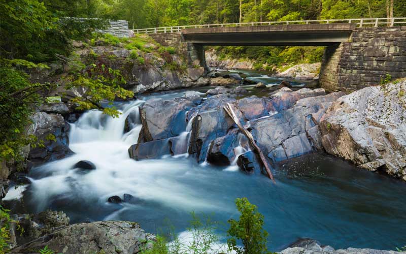
The Sinks is a roadside waterfall on the Little River. It is one of the most popular destinations in the Great Smoky Mountains National Park. It is one of the most beautiful spots along the Little River scenic drive.
This powerful 15 Ft waterfall is named for the large whirlpool at its base that swirls like water draining in a sink. The Sinks is the only waterfall in Gatlinburg that you can drive to. The falls can often be crowded since the site is easy to access, so it is best to visit the Sinks early to get the best views of the waterfall.
This impressive waterfall creates strong currents by channeling the entire volume of the Little River. Over time, the power of the river has created a deep swimming hole that’s delightful to enjoy in the summer months. The parking area to view the falls is along Little River Road, 12 miles west of Sugarlands Visitor Center.
There is no hiking trail to enjoy this waterfall since it is at the roadside and people can drive to it. However, the Meigs Creek Trail does begin at the Sinks if you want a peaceful walk in the woods. This pleasant trail leads hikers to the 18-foot tall Meigs Creek Cascades which is another lovely waterfall in the park.
7. Ramsey Cascades
- Waterfall Height: 100-feet
- Distance: 8-mile round trip
- Level: Strenuous
- Elevation Gain: 2190-feet
Ramsey Cascades is the tallest waterfall in the Smoky Mountain National Park which also makes it the most spectacular. It is the highest waterfall that can be reached via a trail. Ramsey Cascades is 100-foot tall. The water drops overextended rocks and into a small pool where salamanders can be found that are well camouflaged.
The cascades are named after the Ramsey family that once lived in this area. It is an 8-mile round trip hike that is considered strenuous in difficulty. The trail to the waterfall gains over 2000’ in elevation over its 4-mile course. The last third-of-a-mile or so of the trail contains extremely rugged terrain.
For the most part, the trail follows rushing river streams. The last 2 miles pass through an old-growth cove hardwood forest with large tulip trees, basswoods, silverbells, and yellow birches. As mentioned earlier, the last third-of-a-mile or so is strenuous with extremely rugged terrain. Hikers will have to climb several steep rocks and pass through numerous roots, rocks, and boulders.
At 4-miles from the trailhead, hikers will reach the Ramsey Cascades. The park website states that hikers shouldn’t attempt to climb rocks near any waterfall. Several people have been killed trying to do so. A sign at Ramsey Cascades also warns people that four people have died trying to climb the rocks here.
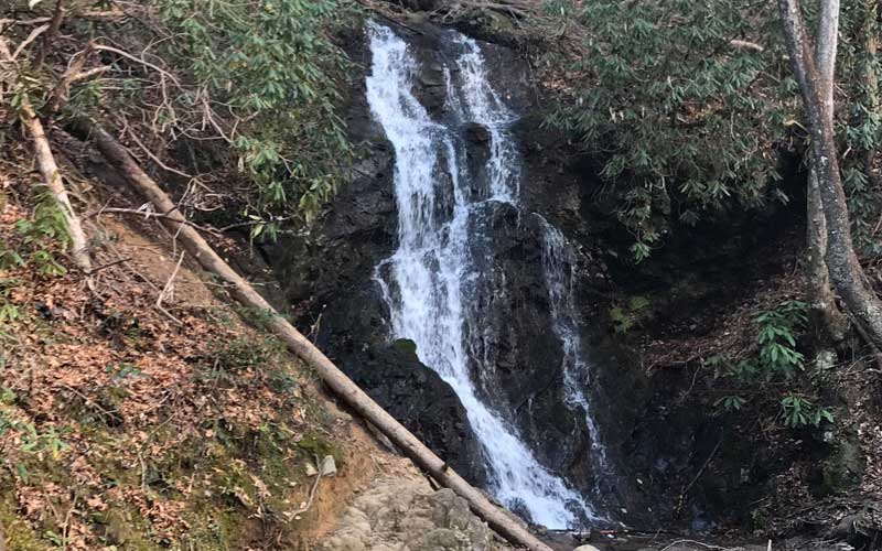
8. Hen Wallow Falls Trail
- Waterfall Height: 90-feet
- Distance: 4.4-mile round trip
- Level: Moderate
- Elevation Gain: 900-feet
The Great Smoky Mountains are famous for waterfalls and Hen Wallow Falls makes you realize why. This tall horsetail waterfall is a popular tourist attraction since the first half of the 20th century. It is located in the northeast section of the National Park and makes for an excellent day hike.
This 90-foot high waterfall begins only as a 2-foot wide creek that fans down to a base that is 20-feet wide. During the drier seasons, water flowing over the rock cliff can be low. The best time to visit the falls is after rain. During the winter season in freezing temperatures, the waterfall freezes and forms beautiful ice columns.
The hike to Hen Wallow Falls is a 4.4-mile round trip along the Gabes Mountain Trail and is considered moderately difficult. The hike takes around 3-4 hours to complete. The trail gains an elevation of about 900-feet and the trail begins to make a steady climb almost from the start and up to the northern flank of Snake Den Mountain.
The trip to Hen Wallow Falls is a pleasant walk through hemlock and rhododendron forest. While ascending the Gabes Mountain Trail, which was once known as the Messer Trail, the roots and rocks will testify just how rough this route can be in some places.