The 7 Hiking Trails in Maine with Waterfalls
Maine is mostly known for its rugged coastlines, rich maritime tradition, and scenic coastal towns. But there is more to Maine than its beautiful coasts. Maine is 90% forest, with a coastline which can reach to California, if stretched out. That means, that you can spend a lifetime exploring the state. The state’s inland lakes and mountains draw thousands of visitors each year because of their amazing natural beauty.
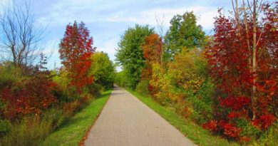
Hiking in Maine is to introduce yourself to the state one step at a time. One of the best-kept secrets in Maine is its waterfalls. There are several hiking trails in Maine that will lead you to beautiful waterfalls. Here some of the hiking trails in Maine with waterfalls.
1. Angel Fall Trail
- Town: Township D
- County: Franklin
- Trail Length: 1.5 miles round trip
- Trail Difficulty: Easy to moderate
- Elevation Gain: Approximately 200 ft.
- Fees: No
Angel Falls is one of the tallest waterfalls in the state of Maine that plunges down 90 ft. In high water, the cascading water creates the shape of an angle giving the waterfall its name. It is one of the most beautiful waterfalls in Maine and is definitely worth visiting.
Angel Falls is located 17.6 miles to the south of the village of Oquossoc. The trail to Angel Falls, hence named, Angel Falls Trail is an easy to moderate hiking trail. It is a 1.5 miles round trip with an approximately 200 ft. elevation gain. The trail is primarily used for hiking and walking. Dogs are allowed on the trail but need to be leashed. The trail is best used from April to November.
Note: Although the trail is classified as an easy to moderate, you will encounter large streams on the route. These streams can be difficult to cross and hop over, even dangerous if the water is flow is high. It is recommended that you should check for the current conditions.
2. Dunn Falls Trail
- Town: Andover North Surplus
- County: Oxford
- Trail Length: 2 miles loop
- Trail Difficulty: Moderate
- Elevation Gain: Approximately 250 ft.
- Fees: No
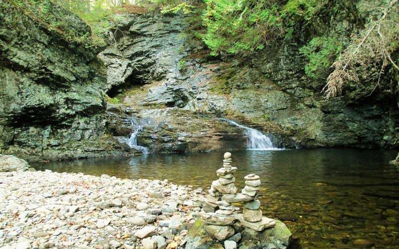
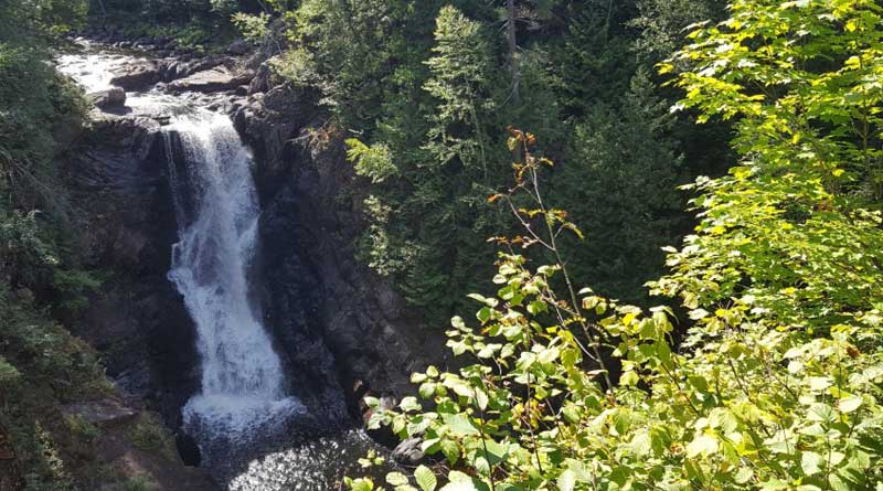
Dunn Falls is another highly-rated waterfall in Maine. Dunn Falls consists of two waterfalls; the Upper Dunn Falls and the Lower Dunn falls. The upper part has a 70 ft. drop forming horsetail and fan. The lower part is an 80 ft. direct plunge.
The trail to the Dunn Falls is considered a moderately difficult hike. The trail is 2 miles in length and forms a loop around Dunn Falls. The loop also consists of a stretch of the Appalachian Trail.
There are several small waterfalls and half a dozen unnamed cascades that you will come across the way until you finally reach the Dunn Falls which is a surprise in itself.
Finding the lower fall is more of a discovery. Before reaching the lower waterfall, you will come across miniature horsetail and cascades and then the 80 feet drop will reveal itself, which is unexpected. The upper fall lies behind two rocky-bottom pools. Both almost 80 ft. in circumference and surrounded by semi-circular rock walls with the waterfall flowing in a secret background.
3. Grand Falls Trail
- Town: Township 3, Range 4
- County: Somerset
- Trail Length: 1-mile round trip
- Trail Difficulty: Easy with a steep pitch
- Elevation Gain: 100 ft.
- Fees: No
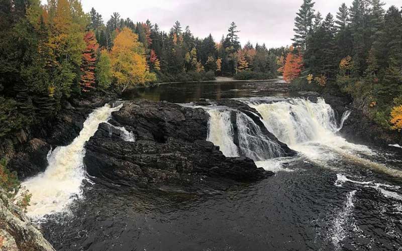
New England has some of the finest waterfalls that are way off the tourist paths. Grand Falls is one such example. This amazing waterfall lies on the Dead River, a famous whitewater rafting river in The Forks. The Grand Falls doesn’t live up to its name in height but certainly does in width.
The scenic falls is a classic example of a horseshoe or block-style falls. The falls is 40 ft. tall and 100 ft. wide. It is accessible any time of the year. The hike is short from the trailhead to the falls in summer. During the winter, snowmobiling to Grand Falls from the Northern Outdoors makes a great full day of sledding (70 miles).
Drive to the trailhead is much longer than the hike itself. There is a parking lot at the end of the Enchanted Road at the Dead River with Spencer stream and Spencer bridge at the right. The road down to Spencer stream leads to the trailhead. The trailhead to the falls is only 0.8 miles away from the Grand Falls Hut, a part of the Maine Huts and Trails (MHT) network of huts and trails. Follow MHT northeast from the trailhead to visit the hut.
4. Gulf Hagas
- Town: Bowdoin College Grant East
- County: Piscataquis
- Trail Length: 7.5-miles round trip
- Trail Difficulty: Moderate
- Elevation Gain: 500 ft.
- Fees: Yes
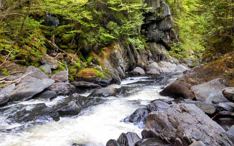
Gulf Hagas is a part of the Appalachian Trail Corridor. A short distance of the Gulf Hagas Rim Trail follows the Appalachian Trail. The section of the Appalachian Trail that goes through Gulf Hagas is called the Hundred-Mile Wilderness. It is the final 100 miles of the Appalachian Trail and is known to be a remote and a difficult track among hikers.
The hike to Gulf Hagas lets you explore a dozen natural features including four officially named waterfalls, dozens of unnamed cascades, swimming pools, a gorge referred to as the Grand Canyon of Maine, and two rivers: Gulf Hagas Brooks and the West Branch of the Pleasant River.
This is easily Maine’s finest day hike.
Screw Auger Fall is the most photogenic of all the falls on the hike. It drops 15 ft. in a punchbowl formation into a deep dark pool encircled by a bowl-shaped rock wall. Three other named waterfalls are reached by going past Screw Auger Falls. The first is the Buttermilk Falls, a 10 ft. horsetail. Beyond that lie the Billings Falls, a 15 ft. plunge, and lastly, the Stair Falls, an extensive system of little stairs cascading over jagged steps. It is just 4 ft. in height.
5. Huston Brook Falls Trail
- Town: Pleasant Ridge
- County: Somerset
- Trail Length: 5-miles round trip
- Trail Difficulty: Easy
- Elevation Gain: 100 ft.
- Fees: No
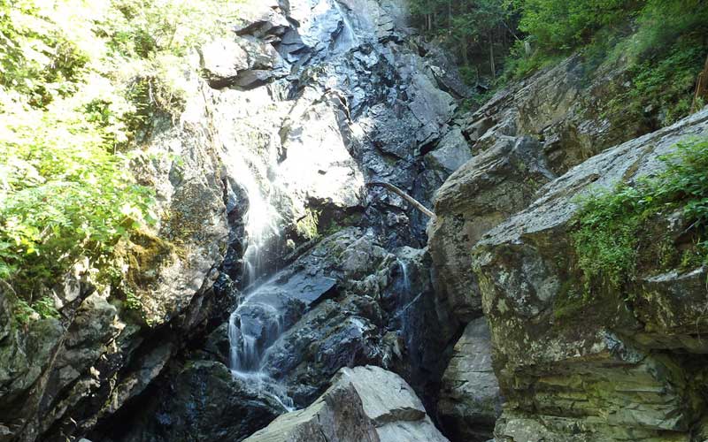
Another scenic waterfall in Maine is the Houston Brook Falls. It is just minutes away from the ME 201 highway. It is a 32 ft. nearly vertical drop. The falls is wild and rugged with jagged rocks throughout the formation. There are few shallow swimming spots, the best being the rectangular channel just below the falls. It is easy to get in the pool when the water is low and difficult in high water.
The trail is to the left of the parking lot. A 10 minutes easy walk through the woods will lead you to the base of the falls. The trail is unmarked but visible and is easy to follow. The trees cover the trail giving a feeling of walking in a large hall with a high ceiling. Tree roots criss-cross the trail making it ideal to stub your toes. Wear sensible shoes to avoid that.
The mist around the falls makes the rocks slick and dangerous to wander around. Be careful while exploring. Just downstream, the brook terminates at Wyman Lake. The same trail will take you back to the parking lot.
6. Moxie Falls Trail
- Town: Moxie Gore
- County: Somerset
- Trail Length: 1-mile round trip
- Trail Difficulty: Easy
- Elevation Gain: 242 ft.
- Fees: No
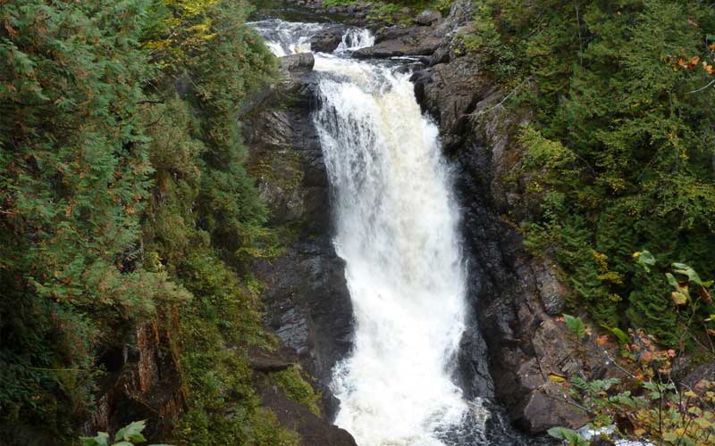
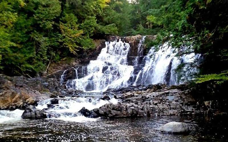
Moxie Falls is one of the tallest waterfalls in the state of Maine. It is located a few miles southeast to the famous whitewater rafting river, the Kennebec. The name Moxie Falls is given to it because of the 90 ft. vertical drop of the Moxie Stream into a 17 ft. pool below.
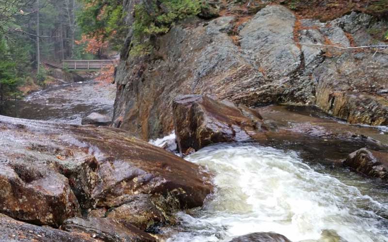
The Moxie Falls Trail is a 1 mile lightly trafficked out and back trail located near West Forks. The trail is primarily used for hiking and walking. The trail starts at the Moxie Falls trailhead. The first half of the trail is quite flat and passes through pleasant mixed woods. The first section includes gravel surfacing and is a bit wider than a primitive hiking trail.
About halfway down the trail, there is a welcome sign which indicates that the falls are not too far away. The trail begins to get steeper within a quarter of a mile. You will encounter a series of wooden stairs and boardwalks providing access over rugged trail surrounding the trail. There are several wooden observation platforms providing different views to the Moxie Stream plunges.
7. Small Falls Trail
- Town: Township E
- County: Franklin
- Trail Length: 2.2 miles
- Trail Difficulty: Moderate
- Elevation Gain: 744 ft.
- Fees: No
Just south of the town of Rangeley, the Small Falls Area attract a huge amount of travelers. Small Falls is a scenic waterfall with colorful gorge and fine swimming holes. This is one of the finest rest areas in New England.
Small Falls is a series of waterfalls and cascades on Sandy River in Township E, Franklin, Maine. It totals 54 ft. in height and consists of a 12 ft. horsetail, a 25 ft. segmented waterfall, a 14 ft. horsetail, and a 3 ft. cascade, all separated by pools. Getting to Small Falls is simple and the entry is just off Maine’s Route 4.
The Step Falls Preserve Hiking Trail is a 2.2 mile moderately difficult trail located near Newry and is good for hikers of all levels. You can use this trail for hiking, walking, and nature trips. From the parking lot, you can go down some stairs to cross a little bridge on Sandy River. Then you can head up the falls either by climbing up the rocks near the fence or opting to go for less extreme interior trials.