Best Hiking Trails in the Great Smoky Mountains
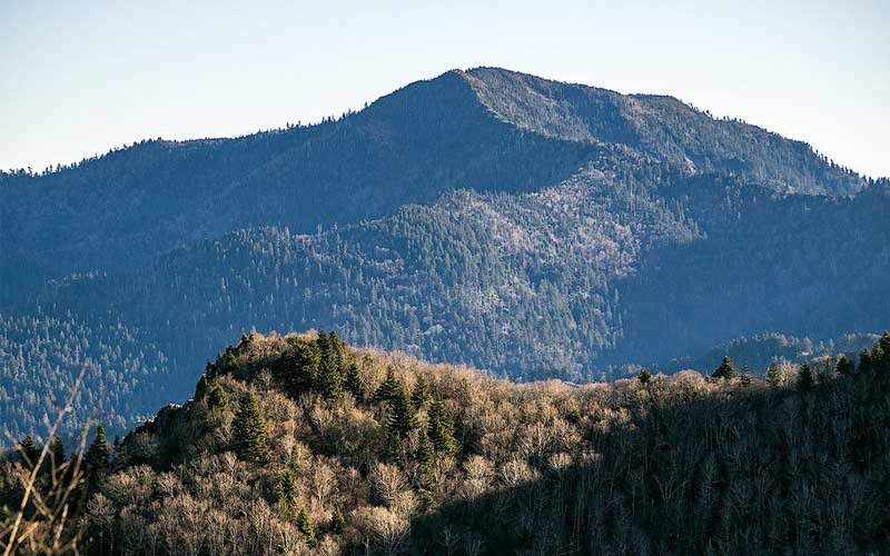
The Great Smoky Mountains are consist of the highest summits of the Eastern United States, the highest being the Clingman’s Dome. It runs at the border of Tennessee and North Carolina in the Southern Appalachian Range known as “Smokies” to the locals.
The Smokies are famous among the National Park System because unlike other national parks, they have no entry fee. In fact, among the several entry points in the park, not one has any entry station.
The Smokies is also the most visited national park in the USA with almost 11 million visitors in 2016, which is double the visitors of Grand Canyons in Arizona. Despite this huge number, the crowd is not an issue in the park.
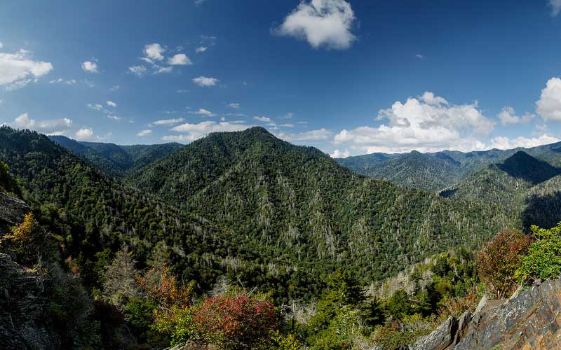
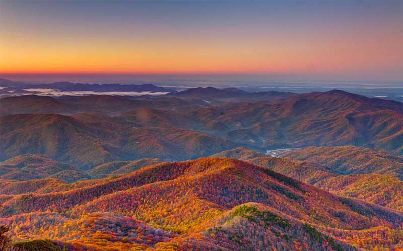
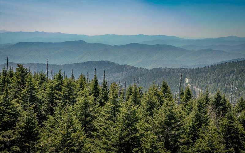
The Smokies have more than just high peaks to offer. The Smokies contain a wide variety of opportunities for hiking that contain thick forests, brilliant fall colors, beautiful waterfalls and an abundance of wildlife.
If you are looking to hike this amazing park, here are the best hikes of the Great Smoky Mountain National Park.
1. The Rocky Top
- Location: Cades Cove Picnic Area
- Elevation Gain: 3665 Feet
- Difficulty: Strenuous
- Roundtrip Length: 13.9 Miles
You would be struggling for the first five miles of this hike until you reach the Spencer Field where your hard work will pay off. During good visibility, the grassy meadows of the Smokies will provide with a spectacular view; even better if you manage to climb it in late spring. That is when the views are unmatched.
The Spencer Field is a beautiful destination. But if you are willing to go the extra mile, the views will get only better. Along the 1.2 miles Appalachian Trail, you will come across the most stunning panoramic views of the North Carolina side of the Smokies. From the summit, you can see Fontana Lake and Cades Cove.
There is a reason for that the lyrics, “Rocky Tops, you’ll always be home sweet home to me.” are the most popular lyrics in Tennessee. The Rocky Top hike is a challenging hike with amazing views.
2. Andrews Bald
- Location: Clingmans Dome Area
- Elevation Gain: 899 Feet
- Difficulty: Moderate
- Roundtrip Length: 3.5 Miles
Andrews Bald is a 3.5 mile round trip that starts at the parking lot of the Clingmans Dome. It is the highest bald in the park and has the most amazing and unique views that you will ever come across.
Andrews Bald is a double peak that resides at the south of Clingmans Dome along the Forney Ridge hiking trail. The hike begins in Tennessee and crosses into North Carolina to reach the bald. The bald spreads around the south slope, unlike other
The Andrews Bald has an elevation of 5,920 feet. It is among the two grassy balds in the national park maintained by the park service. The other is the Gregory Bald in the west of the Great Smoky Mountains.
The road to Clingmans Dome allows easy access to the Andrews Bald making it a 1.8-mile hike, perfect picnic spot for families, but the terrain is still fairly rough. However, during the winter (December-April) the road to the Clingmans Dome is closed which makes reaching the bald, a challenge, a 10-mile hike one way, on the Appalachian Trail southbound.
3. Mount LeConte
- Location: Newfound Gap Road
- Elevation Gain: 3000 Feet
- Difficulty: Strenuous
- Roundtrip Length: 15.6 Miles
Mount LeConte is a mountain is a mountain in Sevier County, Tennessee. It is the third highest peak in the Smokies and the highest in Tennessee.
Mount LeConte is the most popular mountain in the park. It has six ways to get to the summit: the Boulevard, Rainbow Falls, Brushy Mountain, Bull head, Trillium Gap and steepest, shortest and the most popular, the Alum Caves.
There are several notable landmarks along the trail like the Arch Rock, Inspiration Point, and the 80-feet tall Alum Cave Bluff. At 6,360-feet, you will emerge to the LeConte Lodges. It operates from mid-March to mid-November and is the only place where you can sleep overnight on a mountain top.
About a mile from the lodges is the Myrtle point that offers a 360 view of the Smokies and it is the best place to enjoy the sunrise. On the other side of the lodges, the Cliff Top provides an amazing view of the Clingmans Dome and the rolling mountains that lie in the west.
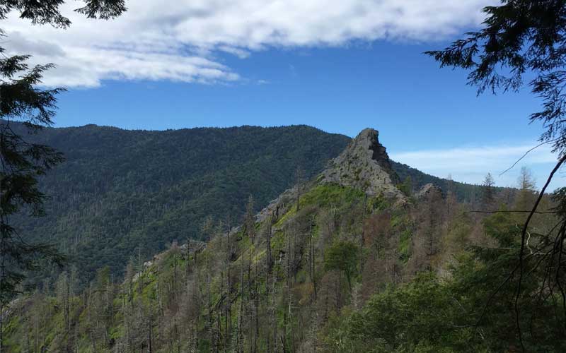
4. Charlies Bunion
- Location: Newfound Gap Road
- Elevation Gain: 1640 Feet
- Difficulty: Strenuous
- Roundtrip Length: 8.1 Miles
Charlies Bunion is perhaps the oddest named mountain in the Smoky Mountain National Park. The trip to the Charlies Bunion is an 8 mile round trip with an elevation of 1600 feet. But that’s not all there is about it.
Charlies Bunion is a rocky outcrop on the Appalachian Trail. It is a treeless trail, but one of the rockiest and spiniest trail in the whole national park and the climb is somewhat
What makes Charlies Bunion on the list of every hiking enthusiast are the panoramic views it offers along the way of the Great Smoky Mountains and the scenery gets better with every step you take.
Charlies Bunion offers the best part of the Appalachian Trail with expansive views of the Smokies. After continuing for several miles, where the Boulevard Trail intersects, you can go to the left to the Jump Off or continue straight to the summit. This is definitely a bring-your-camera hike.
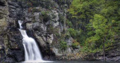
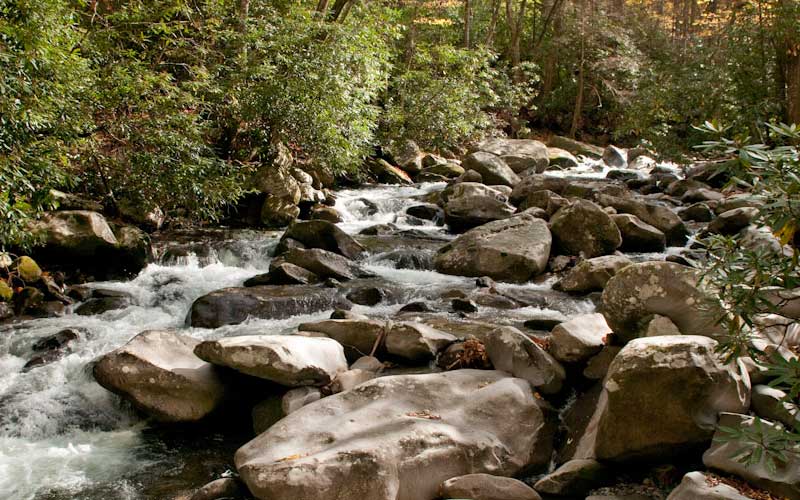
5. Ramsey Cascades
- Location: Greenbrier
- Elevation Gain: 2190 Feet
- Difficulty: Strenuous
- Roundtrip Length: 8.0 Miles
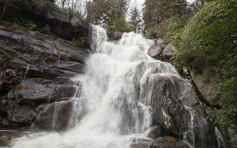
The hike to the Ramsey Cascades is an 8-mile round trip that takes you to the tallest waterfalls in the Great Smoky Mountain National Park. The trail gains 2000-feet in elevation over a 4-mile hike and is considered to be moderately strenuous.
The water falls around a 100-feet over the rocky outcroppings in the form of cascades and collects down in a pond where camouflaged salamanders can be found. The trail follows rushing rivers and streams for the most part.
An old gravel road starts in the east of the parking lot where you will be greeted by large tulip trees, hemlocks, and black cherries. The gravel road ends after 1.5-miles where it transforms into an actual smoky trail. As you move along the trail, you will see the forest unfolding like a scene from a magic story.
After a steep climb, the trial ends at the Ramsey Cascades. It is strongly recommended that you do not attempt to climb the waterfall because several people have been killed or injured seriously. The trail is rocky at some places so hiking shoes and ankle supports are recommended.
6. Rich Mountain Loop
- Location: Cades Cove
- Elevation Gain: 1736 Feet
- Difficulty: Strenuous
- Roundtrip Length: 8.5 Miles
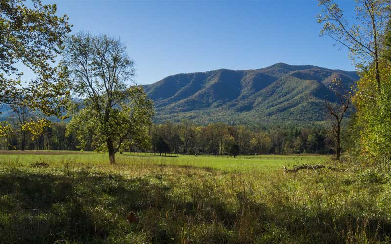
The Rich Mountain Loop is an 8.3-mile tightly trafficked loop near Townsend, Tennessee. It is a great way to enjoy the Cades Cove without the crowds. The trail offers a wide variety of activities and is best utilized between March and October. Horses are also able to use this trail.
The trail offers opportunities for hiking, biking, camping, driving, and horse riding. But what makes this trail special are black bears. You may get lucky and come across one along the trail. The trail is closed for bicycles on Wednesday and Saturday during the summer months.
During the first leg, you will pass through the meadows that make Cades Cove the most beautiful place of the whole national park system. In late spring, these meadows are covered with wildflowers like daisies, jewelweed, black-eyed Susans, butterfly weed and purple phacelia.
7. Chimney Tops
- Location: Newfound Gap Road
- Elevation Gain: 1487 Feet
- Difficulty: Moderate
- Roundtrip Length: 3.3 Miles
Chimney Tops is a twin peaked mountain at a height of almost 4,800-feet in the center of the Great Smoky Mountain National Park. It is one of the most popular and the most rewarding hikes in the national park.
The twin peaks can be seen from the New Found Gap Road but you can’t appreciate it in full unless you get to the top. It is a rare rock summit The trail is popular because of its short length and the stunning views from the summit. Its length is almost 2 miles. The first half is relatively easy. But hikers have to climb a steep 960-feet in the last mile and most hikers don’t make it to the summit.
The trail was damaged in November 2016 by wildfire and remained closed for 11 months before being reopened in October 2017. While the trail remained closed, the park crews constructed an observational deck just before the summit that provides views of Mount LeConte and Chimney Tops pinnacles.
8. Mount Cammerer
- Location: Cosby
- Elevation Gain: 3045 Feet
- Difficulty: Strenuous
- Roundtrip Length: 11.1 Miles
Mount Cammerer promises the best views in the Smoky National Park. Getting to the summit is just so much rewarding. The summit provides a 360-degree panoramic view of the southern Appalachian trail.
The hike to Mount Cammerer starts from the Low Gap Trailhead and is an 11-mile round hike. This is the most popular route since it is the shortest route to the summit. From the Low Gap Trailhead, hikers will hike 3-miles to the Appalachian Trail. By the time hikers reach the Appalachian trail, they would have already climbed 2000-feet and completed the hardest part of the trail.
The summit, at 4,928-feet, is a rocky outcrop from where Pigeon River George can be viewed. On a clear day, the views are stunning with some arguing them to be the best views in the park.
For a better vantage point, you can step up to the stone fire lookout at the summit from where you can see rows of mountains in every direction.
9. Clingmans Dome
- Location: Newfound Gap
- Elevation Gain: 332 Feet
- Difficulty: Moderate to strenuous
- Roundtrip Length: 1 Mile
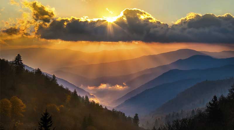
At 6,643-feet, Clingmans Dome is the highest point in the Great Smoky Mountains National Park. In fact, it is the highest mountain in Tennessee and the third highest mountain in the east of Mississippi River.
Being the highest mountain in the park makes it one of the most visited spots as well, and for good reason too. As a start, the sunsets and the sunrises are simply breathtaking. The sunsets reveal the Blue Ridge Mountains in a way that will make you come back to it again and again.
The “Dome” refers to the mountain top, not the man-made observation tower at the summit. The road to the tower is open all year, but it is closed from 1st December to 31st March or whenever the weather conditions become unfavorable due to snow.
At the end of the road there is a large parking area, a visitors center and a trailhead to the summit. The trail is paved, measuring only half a mile in length and leads to the observation tower on top. However, the trial is steep and can be termed as moderate to difficult.
Precipitation and cold temperatures are common at Clingmans Dome. The temperature is 10-20 degree Fahrenheit lower than the surrounding lowland. Hence, proper preparations are required to make a visit. Make sure to dress in layers and take a jacket even in the summers.
10. Porters Creek
- Location: Greenbrier
- Elevation Gain: 699 Feet
- Difficulty: Moderate
- Roundtrip Length: 4.0 Mile
Porters Creek is a 4.5-mile round trip with the trailhead located at Greenbrier. The trail provides lots of opportunities and historical site and is accessible all year. If you hike this trail in the summer, you will find a carpet of yellow trilliums near the trailhead.
The low elevation and gentle slopes make Porters Creek make it a good choice in the spring when other high elevations are unpredictable due to ice or snow. Hikers can walk along the bank of the Porters Creek on a carpet of trilliums to eventually come across a farmstead.
The Elbert Cantrell farmstead and the Ownby Cemetery are historic sites both from the early 20th century. Other historic sites along the path include John Messner’s farm site and a cabin built by the Great Smoky Mountain Hiking Club in the mid 1930s.
At roughly 2-miles hikers come across the Fern Branch Falls at the left side of the trail. During high water flow, the waterfall looks beautiful. The hike ends at this point but the trail continues for another 1.7-miles to Backcountry Campsite 31.