The 8 Hiking Trails in Southeast Michigan
Michigan is one of the most exciting places when it comes to outdoor activities in America. Michigan boasts more than 2,700-miles of rails-to-trails. It is home to the International Mountain Biking Association Silver Level Ride Center in Copper Harbor. Michigan is also home to the longest state trail of the USA the Iron Belle.
If that doesn’t satisfy you, then Michigan also has more than 3,000-miles of water trails for kayaking and canoeing, more than a thousand miles of state-designated trails open to equestrian riders and more than 3,100-miles of off-road vehicle trails. With thousands of miles of these trails, it is easy to understand why Michigan is known as the #1 trail state in the USA.
Southern Michigan is a region in the Lower Peninsula of Michigan, home to most of the state’s businesses and industries. It is also home to over half the population of the state mostly concentrated in Metro Detroit. But that doesn’t mean that this area has any less hiking trails.
So if you are in Southeast Michigan and want to satisfy your hiking addiction, then here are some of the best hiking trails in Southeast Michigan you shouldn’t miss.
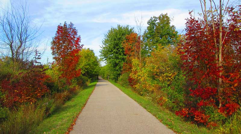
1. Falling Waters Trail
- County: Jackson
- Length: 10.1 miles
- Trail Surface: Asphalt
- Difficulty: Easy
Jackson County was built on an abandoned stretch of the Michigan Central Railroad. The trail serves as an important community connector linking the Village of Concord to the outskirts of the vibrant city of Jackson. The Village of Concord has several homes from Victorian-era making it a good tourist spot.
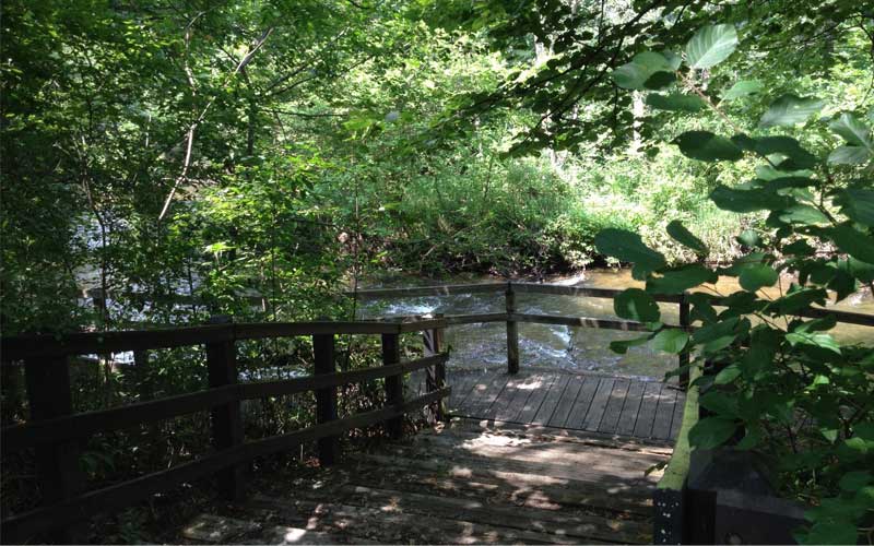
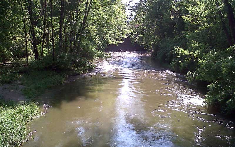
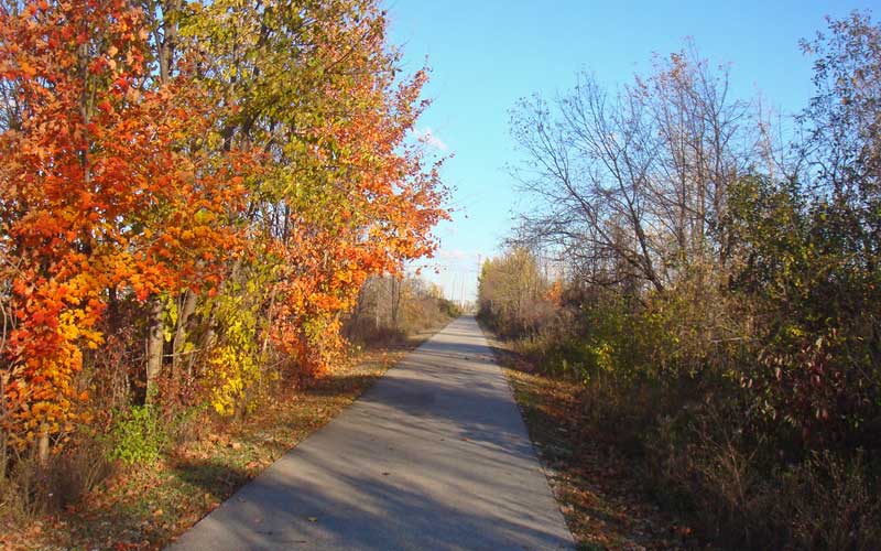
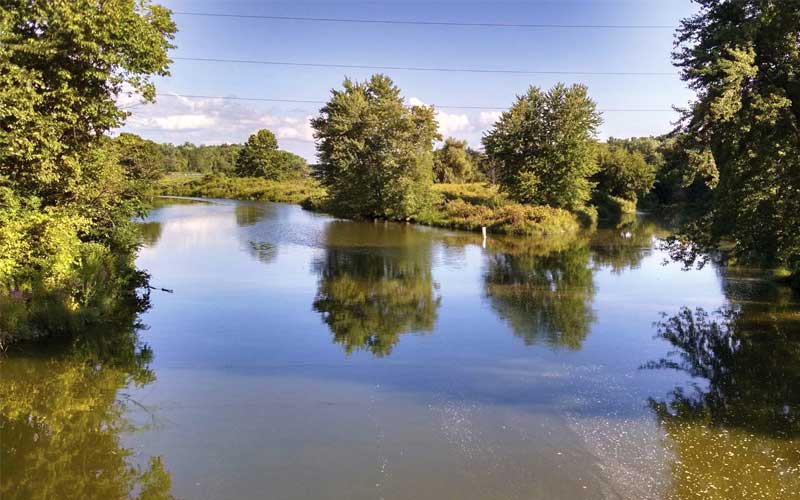
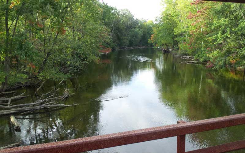
The Falling Waters Trail opened in 2007 and became popular due to its scenery and rich historical connections. The trail travels through natural springs and lakes that form the headwaters of four major Michigan Rivers. The trail is 10.5-miles long and 12-foot wide and paved making it ideal for walking, running, and biking.
Falling Waters Trail mostly passes through country, fields of corn, forests, wetlands, and between two small lakes. It’s popular with bicyclists, runners, dog walkers, and skaters. There are rental bikes available at the trailhead on Weatherbee.
The spot between the two Lime Lakes is wonderful with seating every half mile and picnic tables between the lakes. The whole trail is full of beautiful flora, lush and green, and always well mowed. This is trail is not to be missed. Many people call it the gem of Jackson County.
This is a trail you will want to visit time and time again to experience the seasonal changes in scenery. There is parking at the Concord trailhead and in Jackson at New Leaf Park on Fourth Street and at M.L.
2. Paint Creek Trail
- County: Oakland
- Length: 8.9 miles (one way)
- Trail Surface: Crushed Stone
- Difficulty: Easy
The Paint Creek Trail was the first non-motorized rail-to-trail in the State of Michigan. It is an 8.9-mile linear path located in northeast Oakland County. It is owned and managed by the Paint Creek Trailways Commission (PCTC). The commission meets the third Tuesday of every month at 7:00 p.m. either at Rochester Municipal Hall or the Paint Creek Cider Mills. For meeting dates and locations visit here.
There are occasional face-lifts and renovations that make the trail look as if it was built a few years ago, even though it is the oldest trail of Michigan. Established in 1983, the crushed-limestone trail runs for 8.9 miles between Rochester and Lake Orion through a mostly wooded corridor alongside Paint Creek.
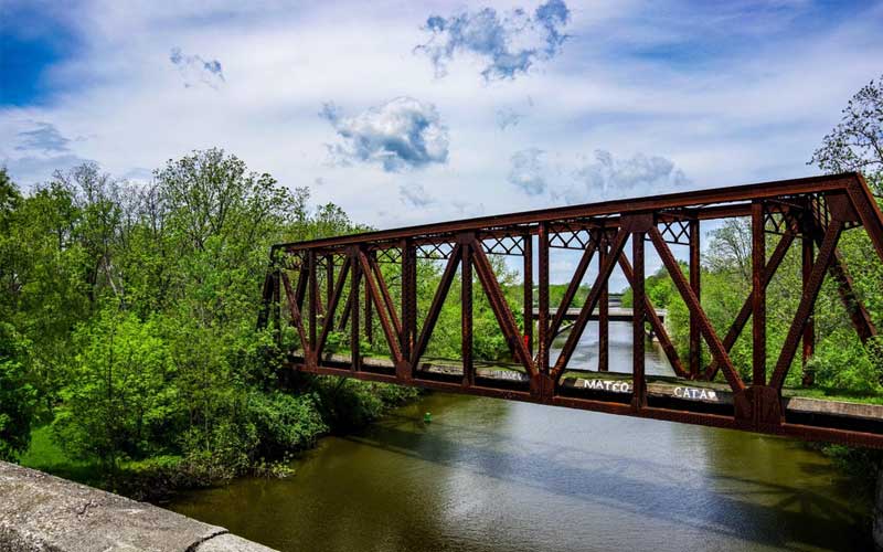
The trail is 8-feet wide and passes through Rochester, Rochester Hills, Oakland Township, Orion Township, and the Village of Lake Orion. The trail surface is asphalt and nicely landscaped through the city of Rochester where it travels under a bridge along Paint Creek.
The limestone surfacing provides a solid but natural surface for non-motorized users like bicycling, hiking, horse riding, jogging and cross country skiing. The trail is a day-use facility only, however. It closes between the hours of 10 p.m. to 6 a.m. This trail attracts around 100,000 users annually.
3. Clinton River Trail
- County: Oakland
- Length: 16 miles (one way)
- Trail Surface: Asphalt, Crushed Stone
- Difficulty: Easy
The Clinton River Trail is a 16-mile recreational trail on an abandoned rail line through the heart of Oakland County, including the cities of Sylvan Lake, Pontiac, Auburn Hills, Rochester Hills, and Rochester. The Clinton River Trail section from the Opdyke Road parking area west to Dequindre Road is almost 9.5 miles long and is the most popular part of the trail.
The corridor used to be primarily a rail trail but it was converted to a multi-use path when rail transportation fell out of favor. Sections of the trail are paved with asphalt with the longest paved section being over two miles long in Auburn Hills. The trail has no rocks or roots making it a pleasant hiking experience.
The western section of the Clinton River Trail connects to the West Bloomfield Trail which is south of Orchard Lake Road. This section is not paved with a dirt/grass surface. This is a popular trail section and is utilized by bikers, walkers, and runners. There are some offshoots but the signs along the trail make it easy to follow the Clinton River Trail.
Parking for the Clinton River Trail is available in Sylvan Lake at Beaudette Park (Dawson’s Mill Pond) off Orchard Lake Road. In Pontiac, parking is available at the trailhead where the trail crosses S. Opdyke Road. There are several other parking areas scattered all along the trail. See the TrailLink map for details.
4. Macomb Orchard Trail
- County: Macomb
- Length: 23.5 miles (one way)
- Trail Surface: Asphalt, Concrete
- Difficulty: Easy
The Macomb Orchard Trail is a 24-mile hike and bike trail that starts at 24 Mile Road and Dequindre in Shelby Township and travels northeast to the City of Richmond. The automotive industry has the most impact on the economy of Macomb County but it’s the freshly picked apples and squeezed cider that attracts visitors to the Macomb Orchard Trail.
The trail is named for its southeastern Michigan’s heritage of bountiful apple and peach production. The paved trail runs from Rochester’s suburbs in metro Detroit to farms and forest lands surrounding Richmond. This trail links to 180-miles of trails in southeast Michigan.
This is a beautiful trail and nicely shaded. The rough stretch just east of the M53 overpass bridge has been paved. The smooth surface of the trail makes it lovely for cycling and enjoying rollerblades.
The trail is very peaceful, not very busy, and at a convenient location. If there seems to be a lot of activities for such a small town, you might have arrived in August during the Armada Fair, an annual event since 1872, or the Lions Club Cider Dayze, also in August, or the Apple Fest in October.
5. Flint River Trail
- County: Genesee
- Length: 27 miles
- Trail Surface: Asphalt
- Difficulty: Easy
Beginning at the University of Michigan’s Flint Campus, the Flint River Trail is a network of approximately 27-miles of paved non-motorized pedestrian paths. The path heads north along both sides of the Flint River to Bluebell Beach, a popular county park that offers plentiful recreational space.
The growing network of trails of the Flint River Trail was built in several phases. The first phase was completed in the early 1980s. Development of this trail network gained momentum in the early 1990s when a group of cyclists began hosting Sunday after-noon bike rides and advocated for the expansion of the trail. The difference in the ages of the trail is noticeable as you travel from the city’s urban area north along the river through several parks and natural areas along Mott Lake.
Along the way, you will pass through some older neighborhoods, a few city parks. You can learn Flint’s heritage from wayside historical signs. The trail was extended, in 2010, to the west of University of Michigan into the historic Carriage Town, passing by Atwood Stadium, Chevy Commons park at the former “Chevy in the Hole” site, the Kettering University campus, and the charming neighborhood park and recreation area at Mott Park.
6. Border-to-Border Trail
- County: Washtenaw
- Length: 35 miles
- Trail Surface: Asphalt, Broadwalk, Crushed Stone
- Difficulty: Easy
The Border-to-Border Trail is a long term plan of the Washtenaw County Parks and Recreation Commission. The total length of the trail is 35-miles and it is a non-motorized, multi-use path along the Huron River in Washtenaw County extending from its northern to the eastern border.
With the help of many communities and organizations, which are working in collaboration with the authorities, three sections of the planned route have been completed which include Ann Arbor to Ypsilanti, west of Ypsilanti along Ford Lake, and the section north and south of Dexter which is the newest. The fourth section is still in progress. The trail stretches across the borders of Washtenaw to the Livingston county in the northwest and Wayne County in the east.
The beginning of the path in the north is an important connection between Hudson Mill Metropark and downtown Dexter. A 1,500-acre woodland in this area provides a wide range of opportunities for recreation including golfing, fishing, cross-country skiing, camping, and hiking.
There are several access points and places to park along this trail in Ann Arbor and Ypsilanti. Huron Bridge River, Bandemer Park, Broadway Park, Riverside Park, Agro Gallup Park off McAuley Drive near St. Joseph Hospital, the ball fields on the Fuller Road near the Veterans Hospital, and Eastern Michigan University are all places to park and access the trail.
7. Genesee Valley Trail
- County: Genesee
- Length: 4.43 miles
- Trail Surface: Asphalt
- Difficulty: Easy
The Genesee Valley Trail is built on an abandoned railway which once significant to Michigan’s automotive industry. Almost 4.5-miles long, this trail runs from Genesee Valley Center on Linden Road to Chevy Commons near downtown Flint.
Chevy Commons is a new city park that is in development. One interesting thing to note about this city park is that it is being built on the site of the original Chevrolet assembly plant which was demolished several years ago.
The trail begins in the southwest at the Genesee Valley Center mall. Genesee Valley Trail is a smooth, paved rail-trail that was designed with HAWK (high-intensity activated crosswalk) signals which provide safe passage across busy city streets. The trail was completed in 2015.
The bulk of the trail follows a defunct corridor of the Grand Trunk Western Railroad, which once serviced the factories and industries along the Flint River that propelled the city’s growth. Now, this corridor provides trail users with a direct and easy path into the city and also connects to the backbone of the area’s trail network.
8. Polly Ann Trail
- County: Oakland, Lapeer
- Length: 34 miles
- Trail Surface: Asphalt, Ballast, Crushed Stone
- Difficulty: Easy
The Polly Ann Trail is a 34-mile long, non-motorized trail that extends north from suburban Detroit on a former Pontiac, Oxford, and Northern Railroad corridor. The name of the trail comes from a dubious nickname for the PO&N Railroad. The railroad was never profitable and seldom arrived on time. This railroad passes through some of the most beautiful and untouched landscapes in northern Oakland County.
The trail passes through the Lapeer County and Oakland County and is managed separately by groups in both counties. Hence, the difference in experience along the trail is different. The trail surface is smoother in the Oakland County while it is rough in the Lapeer County.
The section of the trail in Oakland County has a crushed stone surface. It has a length of 14.2-miles and extends from Orion Township to the Oakland-Lapeer county line. The sections passing through urban areas have an improved asphalt surface.
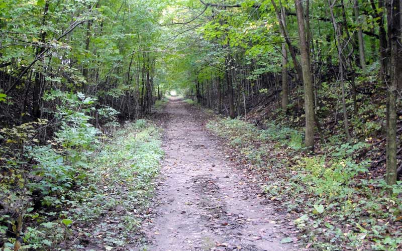
In Lapeer County, the surface is a much rougher ballast surface. The trail extends 20-miles north to North Branch Township. The trail is maintained in Dryden Township, Dryden Village and Imlay City. The rest of the trail is largely rough, uneven, and wet in spots making it ideal for mountain bikers.