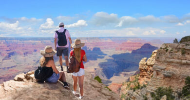
Top 10 Best Mountains to Climb in the UK
Climbing a mountain is a great way to escape one’s regular boring life. Nothing can beat the satisfaction of reaching the top of a mountain. It feels like a huge achievement, one you can be proud of, the one that you can brag about for a long time.
There are plenty of mountains in the World but the UK has mountains that are suitable for all levels and you don’t have to travel far. So that doesn’t leave you with any excuse to not try it. If you have no clue about where to start, or you’re searching for the next mountain to add to your bucket list to conquer it in vacations, then we might help.
This guide may help you decide your first or next mountain to climb. According to us, here are the best mountains to climb in the UK.
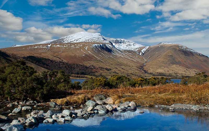
1. Helvellyn
- Height: 3,118 feet (950 metres)
- Location: Lake District
- Difficulty: Moderate – Strenuous
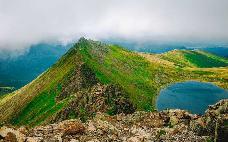
With 3,118 feet (950 metres) of height, the Helvellyn is the second highest mountain in England, and the Lake District. In a recent survey, it has finished first as Britain’s best walks. Its stunning ridges, Striding Edge and Swirral Edge are the two most popular routes that make it England’s best mountain.
The shortest route to the top is the direct route from Thirlmere which is only over 2 miles (3.5km). This route takes about 3 hours to get you to the top. It can be a lot less if you are fit. But Striding Edge coupled with Swirral Edge is no doubt the best trail on Helvellyn. There are also other hiking routes that are both easy and difficult making this mountain much more interesting.
On your ascent of Helvellyn, you will find glacial coves and the sharp ridges of Swirral Edge and Striding Edge. The views at the top of the mountain, on a clear day, are worth all the effort you make and lets you enjoy mesmerising views stretching from Wales to Scotland. Depending on the route taken, all the routes require a significant amount of climbing and a good level of fitness.
2. Ben Nevis
- Height: 4,411 feet (1,345 metres)
- Location: Lochaber
- Difficulty: Easy – Strenuous (depends on the route)
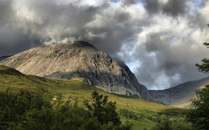
Ben Nevis is the highest mountain in the British Isles. It is located in the north-west highlands near the town of Fort Williams and a part of the Grampian Range. Standing at 4,411 feet (1,345 metres), this peak attracts 1,25,000 walkers each year for the beautiful landscapes it offers.
Ben Nevis was once a massive active volcano which exploded and collapsed inwards on itself millions of years ago. The evidence of the explosion can be found on the summit in the form of light-coloured granite. The name itself has two meanings from the ancient Gaelic language. The first is the ‘mountain with its head in the clouds’ thanks to its mist-shrouded peak, or it can also mean ‘venomous mountain’.
There are two main walking routes up Ben Nevis. The first route is the Mountain Track, also known as the Tourist Route or the Pony Track, is the easier route to the summit that starts with a steep climb. The second route is Carn Mor Dearg. It is a challenging ridge climb which should only be attempted by experienced scramblers and physically-fit hill walkers. Although difficult, it rewards climbers with best views of the mountain’s north face.
3. Ingleborough
- Height: 2,372 feet (723 metres)
- Location: Yorkshires Dale
- Difficulty: Moderate
At 2,372 feet (723 metres), Ingleborough is the second highest peak in the Yorkshires Dale. It is one of Yorkshire Three Peaks, the other two being Whernside and Pen-y-Ghent. Ingleborough is arguably the most popular and most recognisable fell in the Yorkshires Dale due to the interesting route up from Clapham providing a great scene-setter from the fine views from the top.
Ingleborough is instantly recognisable due to a stepped profile formed by alternating layers of sandstone, limestone, and shale which form the bulk of the mountain beneath its gritstone cap. The rocks laid out on the top were part of an Iron Age or earlier. Aerial photography shows that the mountain top once had a stone wall and other circular stone structures. These Iron Age huts have been identified as defensive hillforts.
The Ingleborough is also known as the Hollow Mountain. There is a complex system of caves deep below the mountain. The Ingleborough Cave and the White Scar Cave are two show caves that are worth visiting. The Battlefield Cavern of White Scar Cave is an amazing sight. Gaping Gill is one of the largest underground caverns in Britain which lies between Ingleborough Cave and Ingleborough itself.
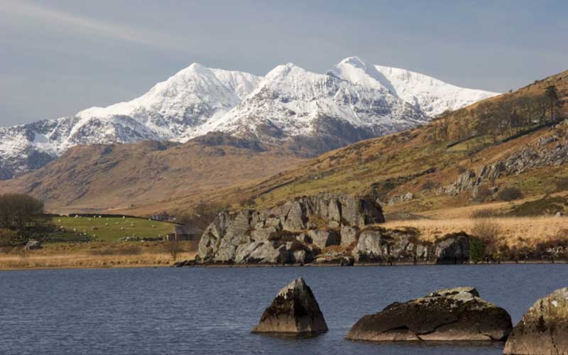
4. Cadair Idris
- Height: 2,930 feet (893 metres)
- Location: Snowdonia
- Difficulty: Easy
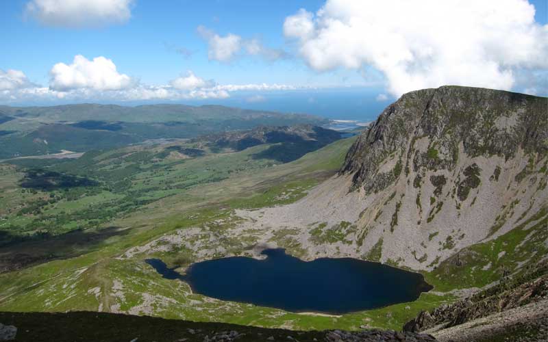
Cadair Idris is located at the southern end of Snowdonia National Park near the town of Dolgellau. At 2,930 feet (893 metres), it is one of the most popular mountains in Wales for walkers and hikers. It is also a National Nature Reserve where some of the rarest wildlife habitats and geological features can be found.
Local folklore describes Idris as a giant who lived on the mountain. Cadair Idris is Welsh for “Idris’s Chair”. The large boulders on the lower slopes are said to be present because of the stone-throwing battles between Idris and the other giants.
There are four walking trails on the Cadair Idris. Two of these follow flat paths in the parkland. These two short trails can be combined to make a longer walk. The other two trails are short but steep climbs from the visitor centre on to the National Nature Reserve. The walks are reasonably straightforward with no scrambling.
5. Sgurr nan Gillean
- Height: 3,710 feet (966.1 metres)
- Location: Isle of Skye
- Difficulty: Strenuous
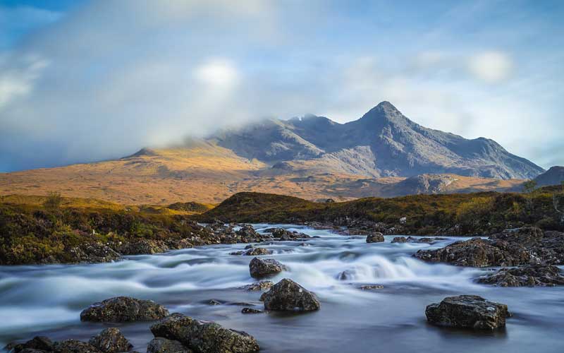
The Cuillin Ridge is the finest ridge, not only in Britain but arguably anywhere in the world. It stretches 12km from one end to the other along narrow ridges and over jagged rock peaks. The peak that stands out is Sgurr nan Gillean, with a height of 3,710 feet (966.1 metres), at the north end of the ridge. It is one of the most northerly peaks on the Black Cuillin Ridge and the finest with its sharply pointed summit.
The Cuillin are composed of gabbro rock which gives fantastic grip even when wet. But these mountains have narrow ridges and pointed summits which require scrambling or even rock-climbing to reach the summit.
The route to the ridge can be difficult to follow in mist. The scramble up the ridge is exposed and difficult. Sgurr Beag is a nearby peak that offers itself as an easier alternative for walkers who decide to pass on Sgurr nan Gillean.
6. Great Gable
- Height: 2,949 feet (899 metres)
- Location: Lake District
- Difficulty: Moderate
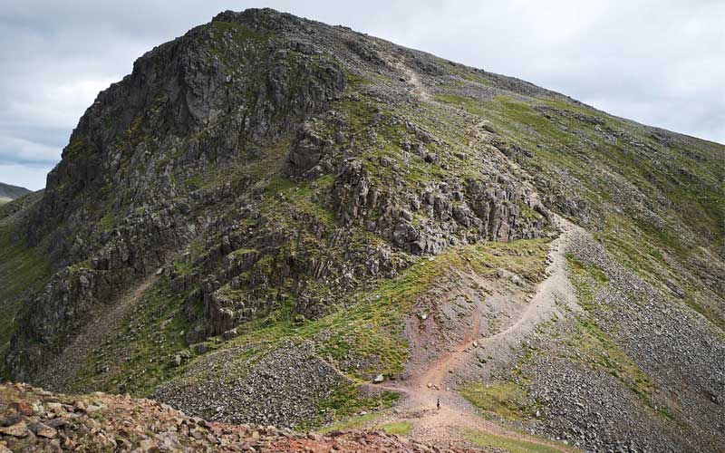
The 2,949 feet (899 metres) Great Gable is situated in the Lake District of Great Britain. It is named for its appearance as a pyramid from Wasdale. Great Gable is linked by the high pass of the Windy Gap to its sister hill, Green Gable and by the lower pass of the Beck Head to its western neighbour, Kirk Fell.
You will have beautiful panoramic views and huge boulders on reaching the summit. You will also get to explore one of the well-known Adventure Peaks Lake District Guided Walks. There are several other routes through which you get to explore the mountain even if you do not want to climb the summit.
Ascents can be made from different angles depending on what you want to achieve from your walk. The mountain is centrally placed in the National Park. Its position in the lakes gives it excellent panoramic views of the whole area. The highest point is marked with a rock outcrop. The ascents are steep near the top that will require some scrambling.
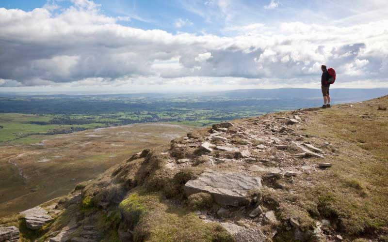
7. Pen-y-Ghent
- Height: 2,277 feet (649 metres)
- Location: Yorkshires Dale
- Difficulty: Easy – Moderate
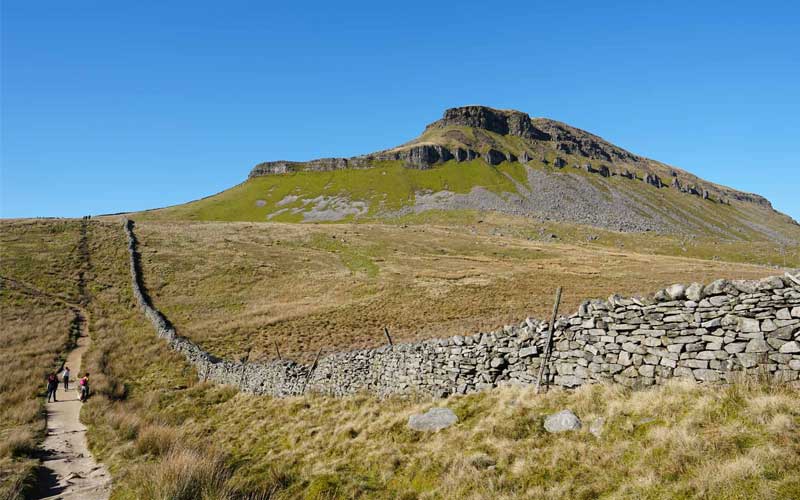
At 2,277 feet (649 metres), the Pen-y-Ghent is the smallest of the Yorkshire Three Peaks. This mountain features several geological features including the Hunt Pot, and further down, Hull Pot. The waters that flow in have created an extensive cave system which arises at Brants Gill head. If you are climbing in wet weather, then watch out for the waterfall created at the Hull Pot.
Starting the Yorkshire Three Peaks from Horton-in-Ribblesdale, and walking in a clockwise direction, Pen-y-Ghent is the first peak to be ascended. Path to Pen-y-Ghent can be found along the road to Brackenbottom Farm, turning off to the left just before the farm itself by the church.
The walk begins as a gentle climb. The mountain is hidden from the view until you reach Brackenbottom Scar, where it appears in view. The climb is short and becomes steep as you reach close to the summit. Once you reach the summit, the views are amazing with Whernside and Ingleborough clearly visible to the northeast. The walk down from the Pen-y-Ghent continues to the Hull Port.
8. Snowdon
- Height: 3,560 feet (1,058 metres)
- Location: Snowdonia
- Difficulty: Easy
Standing with a height of 3,560 feet (1,058 metres), Snowdon is the tallest mountain in Wales and the highest point in the British Isles outside the Scottish Highlands. Snowdon is located in Snowdonia National Park in Gwynedd. It is the most popular mountain in the United Kingdom with 5,82,000 people visiting every year. It has rare fauna and flora for which it has been declared as a national nature reserve.
There are six paths to reach the summit, of which, Llanberis Path is the most popular. Through the summer, this path is very busy. One reason that makes this mountain so popular is that it is very accessible. Anyone who is reasonably fit with no health problems should be able to climb up and come back in around 8 hours.
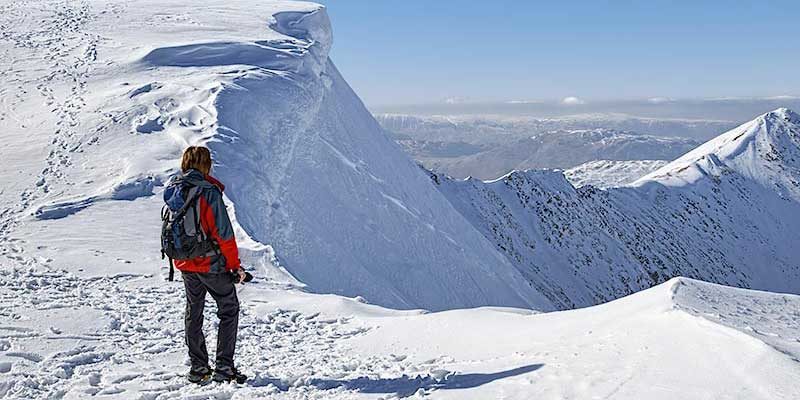
9. Scafell Pike
- Height: 3,209 feet (978 metres)
- Location: Lake District
- Difficulty: Moderate – Strenuous
Scafell Pike is the highest mountain in England with an elevation of 3,209 feet (978 metres). It is located in the Lake District National Park in Cumbria and is a part of the Southern Fells. The mountain is also home to Broad Crag Tarn, the highest standing water in England with no buildings. The hike usually takes around 2-3 hours and can be done using a number of routes. But the hike is tough and involves scrambling over hard and steep terrain.
This is also the site of England’s highest war memorial, donated to the National Trust 1919 in memory of the soldiers who died in the First World War. Scafell Pike is also a part of the Lakeland 10 Peaks Challenge, which requires conquering 10 peaks in one day over a 27 km long route.
Climbing Scafell Pike is serious business, one that should not be underestimated. Any route taken is tough. There could be high winds, snow, rain, cold weather or poor visibility. Before heading for the hike, check the mountain forecast and use the right clothes and equipment.
10. Tryfan
- Height: 3,010 feet (917.5 metres)
- Location: Snowdonia
- Difficulty: Strenuous
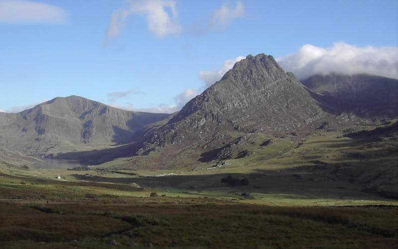
Tryfan is situated in the Ogwen Valley, Snowdonia and forms part of the Glyderau group. It is one of the most recognisable and famous peaks in Britain having a classic pointed shape. At a height of 3,010 feet (917.5 metres), it is the fifteenth highest mountain in Wales. The name Tryfan is derived from Welsh making a reference to the three rocky humps seen on the summit.
Tryfan is considered a line between scrambling and mountaineering. The closer you get to the top, the more you would need to use your hands and feet. Tryfan can also be dangerous if it is not given the proper respect it deserves. It claims lives every year and is often the scene of various accidents throughout the season.
Tryfan won a survey amongst walkers as the best mountain in Britain. All the routes up Tryfan are hard, even the South Ridge which is the least difficult. Tryfan North Ridge is the best walking route up Tryfan. The direct route to the top is only around 3km, but you would have to use your hands a lot. An experienced scrambler can complete the North Ridge in a few hours but slow parties in front can slow you down.